
A rapidly growing wildfire burning northwest of , Nevada, has expanded to approximately 8000 acres, per the National Intragency Fire Center. The Hawk Fire, which was initially reported just before 11:30 am on Saturday, swiftly moved through Washoe County’s rugged terrain in the face of hazardous fire weather.
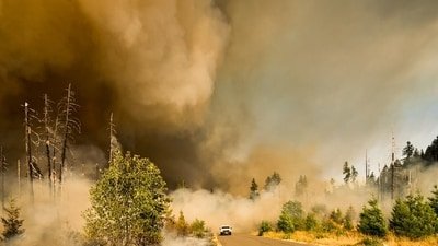
The fire has prompted mandatory evacuation, road closures and an extensive fire fighting operation. Officials warned residents to leave immediately as evacuation zones expanded throughout the day.
The fire is burning on US Forest Service land in the Humboldt-Toiyabe National Forest, north of Interstate 80 and south of US Highway 395. Authorities said the blaze is advancing in rugged terrain, while strong winds under a Red Flag Warning have increased the risk of rapid fire growth and spot fires.
Also read: Reno wildfire update: Scary videos emerge as Hawk Fire explodes to 2,500 acres near Somersett; evacuations underway
Also read:
Where is the Hawk Fire burning? Map and evacuation zones
The Washoe County Sheriff’s Office upgraded several neighbourhoods from “Get Set” evacuation warnings to “Go Now” mandatory evacuation orders. Officials said all communities from Raleigh Heights to Red Rock on the west side of US 395 must evacuate immediately.
Residents can view the latest evacuation boundaries through the , which is being updated as conditions change.
Approximately 1,000 homes along the US 395 corridor now fall within mandatory evacuation zones.
Authorities also closed U.S. 395 between Parr Boulevard and Red Rock Road, urging motorists to avoid the area and use alternate routes until further notice.
One of the major facilities being closely monitored is the Washoe County Detention Facility, which lies near the wildfire. Washoe County Sheriff Darin Balaam said officials are working closely with fire and emergency agencies to protect inmates and staff.
“The safety and security of every incarcerated individual, as well as our staff, remains a top priority,” Balaam said, adding that authorities are prepared to take further action if conditions worsen.
The wildfire has also prompted evacuation orders in neighbouring Sierra County, California, highlighting the regional impact of the rapidly expanding blaze.
Truckee Meadows Fire Chief Richard Edwards has said that the Hawk fire is moving quickly. He has advised residents in evacuation zone to not wait to go with their go bags and important documents ready.
Also read:
Fire crews battle dangerous conditions
Local, state and federal firefighting agencies have deployed significant resources to contain the Hawk Fire.
Officials said the response includes air tankers, two helicopters and ground crews, while additional assistance from Cal Fire has been requested. Firefighting resources previously assigned to the now-contained Bug Fire have also been redirected to support suppression efforts.
Weather conditions remain challenging. A Red Flag Warning extends across northern Washoe County toward the California and Oregon borders
‘Homes have already burned down’
Social media users have shared updates and videos on the progressing fire. Evacuated members of the community have shared that multiple homes have already been affected by the Hawk fire.
A user who got evacuated on X, “I got evacuated from the Hawk Fire a few hours ago. Homes have already burned down near my house. I grabbed my pets and what I could fit in my truck and headed to my sister’s house in Fernley. Heartbroken I might lose my home. Please pray for all of us in Peavine.”
Another user shared pictures of wallowing smoke and wrote, “Hawk Fire headed toward Lemon Valley, Hwy 395 closed N of Reno.”
Sports Journalist Grant Kiefer also shared a video from the Mackay Stadium with smoke bellowing around. He wrote, “Genuinely an apocalyptic feel. Hawk Fire burning 2,500 acres and counting beyond Mackay Stadium, with high school games still rolling on forward tonight.”
Richard Edwards, the fire chief for Truckee Meadows, described it as a highly dynamic situation that was solely caused by the wind. He claimed that wind-driven fires spread quickly into residential areas, making it challenging for firefighters to rescue homes and preserve lives.