
Residents in parts of southwest were urged to take immediate shelter on Friday night after the National Weather Service (NWS) issued a Tornado Warning for Gate City, Weber City and Clinchport.
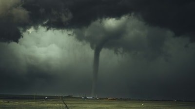
The warning came as severe thunderstorms capable of producing damaging winds, large hail and possible tornadoes tracked across Lee, Scott and Wise counties. Storm spotters also reported a funnel cloud near Fort Blackmore as conditions rapidly deteriorated.
According to the NWS, the tornado warning remained in effect until 10:15 pm EDT for portions of Lee and Scott counties. This includes Gate City, Weber City and Clinchport.
Also read:
NWS advised residents to move immediately to a basement or an interior room on the lowest floor of a sturdy building.
The NWS has also maintained a Severe Thunderstorm Warning for Lee, Scott and Wise counties until 9:45 pm EDT. Meteorologists warned that the storm was capable of producing 60 mph wind gusts, quarter-size hail and conditions favourable for tornado development.
Maps show storm moving toward Gate City
The latest NWS warning placed the storm about 9 miles northwest of Gate City, moving southeast at approximately 25 mph.
Forecasters said communities expected to be impacted included Big Stone Gap, Duffield, Clinchport, Dryden, Jasper and Pattonsville.
Maps accompanying the warnings highlighted the affected portions of Lee County, Scott County and Wise County in southwest Virginia. Residents were encouraged to monitor updates through the NWS, local emergency management agencies and NOAA Weather Radio.
Meteorologist David Boyd of WCYB also alerted residents about the severe thunderstorm warning
Funnel cloud reported near Fort Blackmore
As the storm intensified, weather spotter Dr. Crawfish Weather on X that he and Morristown NWS witnessed a funnel cloud descending near Fort Blackmore, Virginia. “Good call tornado warning,” the post read. The weather tracker added that hail was already impacting the location.
Also read:
The NWS said the storm posed several hazards beyond the tornado threat. These included hail damage to vehicles, fallen trees, power outages and structural damage caused by winds reaching 60 mph.
Officials advised residents to stay away from windows, charge electronic devices in case of power failures and avoid travelling until the storms pass.