
A Flash Flood Emergency was issued for parts of northern Knott County, Kentucky, late Thursday. Heavy rainfall triggered life-threatening flooding in multiple communities, including Mousie, Vest, Handshoe and Bolyn.
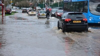
According to weather broadcaster Ryan Hall, law enforcement had already reported flooding on the ground after 2.5 to 4 inches of rain fell across parts of Knott County. Forecasters have warned that more rainfall is expected overnight. Authorities warned residents to seek higher ground immediately
Hall has urged residents not to drive through flooded roads. “Please don’t drive through flooded roads tonight, it’s too dark to judge how deep that water really is,” he wrote in a.
Also read:
Floodwaters approach homes in Mousie
Videos and images shared by residents and meteorologists on social media showed rapidly rising water in Mousie, one of the communities under the emergency warning.
Weather observer Chris Hall reported that major flash flooding was underway on Bear Fork Road in Knott County. He said floodwaters were approaching homes and continued to rise as heavy rain persisted.
According to the NWS, flash flooding may affect small creeks, streams, low-water crossings, highways, streets and underpasses. Officials stressed that conditions could deteriorate rapidly overnight because of continued rainfall.
The highest-level flash flood alert covers Mousie, Vest, Handshoe, Bolyn, Yellow Mountain, Soft Shell, Larkslane, Elmrock and Betty, where law enforcement reported ra
Residents with emergency situations were urged to contact local authorities immediately and avoid relying solely on social media for weather information.pidly rising water and dangerous conditions.
Also read:
Multiple flash flood warnings issued across eastern Kentucky
Eastern Kentucky has experienced repeated flooding events in recent years because of its steep terrain and narrow valleys, which allow heavy rainfall to collect quickly in creeks and rivers.
The Flash Flood Emergency followed several warnings issued earlier Wednesday evening across eastern Kentucky.
The NWS first warned residents in Northern Breathitt County, West Central Floyd County and Northern Knott County, where radar indicated thunderstorms producing heavy rainfall. Between 1.5 and 3 inches of rain had already fallen in some locations before additional storms developed.
Additional Flash Flood Warnings were later issued for South Central Floyd County, Central Knott County, Southeastern Knott County, East Central Leslie County, Letcher County, Southeastern Perry County and Southwestern Pike County as intense thunderstorms continued moving across the region.