Tropical Storm Arthur formed Wednesday off the Gulf Coast of Texas, becoming the first named storm of the Atlantic hurricane season.
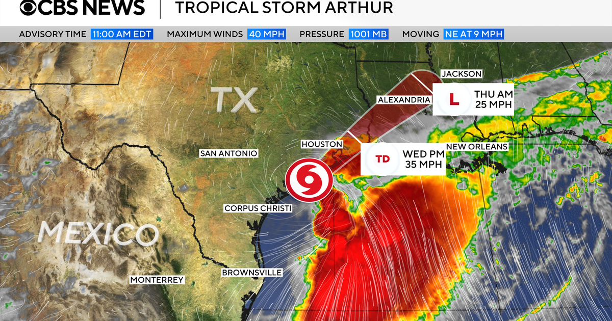
The storm developed near the middle of the Texas coast, about 40 miles from Port O’Connor and 190 miles from Lake Charles, Louisiana, according to the National Hurricane Center. It was traveling northeastward with maximum sustained winds of 40 mph, which just cleared the threshold to be considered a tropical storm.
Minimal changes in strength are forecast as Arthur makes its way toward and, potentially, onto land, the National Hurricane Center said. But the storm is expected to speed up while its center moves either along or over coastal Texas at some point on Wednesday. After continuing on its track into southern Louisiana, Arthur is expected to turn inland before weakening.
Regardless of Arthur’s progression, the National Hurricane Center warned the storm would continue to bring heavy rain and flooding to a vast stretch of the southeastern United States, from Houston to Atlanta. In an advisory, forecasters said the storm was “expected to cause life-threatening flooding” and powerful winds in parts of the region.
Tropical storm warnings were in place from High Island, Texas, to Morgan City, Louisiana, meaning tropical storm conditions were expected in those areas within 12 hours. A tropical storm watch was also issued from Sargent, Texas, to High Island, which means tropical storm conditions were possible within the same time frame, but not necessarily guaranteed.
Arthur started developing earlier this week, as a tropical disturbance in the western Gulf of Mexico. It emerged and strengthened as coastal communities in the path of the storm contended with ongoing bouts of intense rain, which triggered dangerous flash flooding in multiple states.
Arthur will likely dump 5 to 10 inches of rain on sections of Texas, Louisiana, Mississippi and Alabama, along with western portions of the Florida Panhandle. They also warned that storm surge could reach 4 feet above normal levels in coastal areas that normally stay dry, depending on the timing of high tide.
“The deepest water will occur along the immediate coast near and to the east of the landfall location, where the surge will be accompanied by large and dangerous waves,” the National Hurricane Center said.
The storm was also expected to produce “life-threatening surf and rip current conditions along the northwestern Gulf Coast for the next couple of days,” it added. Some tornadoes may be possible, too.
Atlantic hurricane season runs from June 1 to Nov. 30, although tropical storm and hurricane activity usually peaks between August and October. Forecasters predicted this season will bring fewer storms than an average year, with the National Oceanic and Atmospheric Administration’s latest outlook calling for eight to 14 named storms, of which three to five might grow into hurricanes.
contributed to this report.